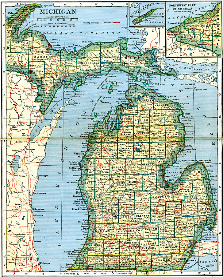
Description: A map from 1919 of Michigan showing the capital city of Lansing, counties and county seats, major cities and towns, railroads, rivers, and lake shoreline. An inset map shows the northwestern continuation of the Upper Peninsula with a detail of Isle Royal.
Place Names: Michigan, Battle Creek, �Detroit, �East Saginaw, �Flint, �Grand Rapids, �Jackson, �Kalamazoo, �Lansing, �Niles, �Pontia
ISO Topic Categories: oceans,
location,
inlandWaters,
transportation
Keywords: Michigan, borders, �physical, �railroads, �transportation, �country borders,
county borders, railroads, oceans,
location,
inlandWaters,
transportation, Unknown, 1919
Source: L.L. Poates, Poates Complete Atlas of the World (New York, NY: Poates Corporation , 1921) 68-69
Map Credit: Courtesy the private collection of Roy Winkelman |
|