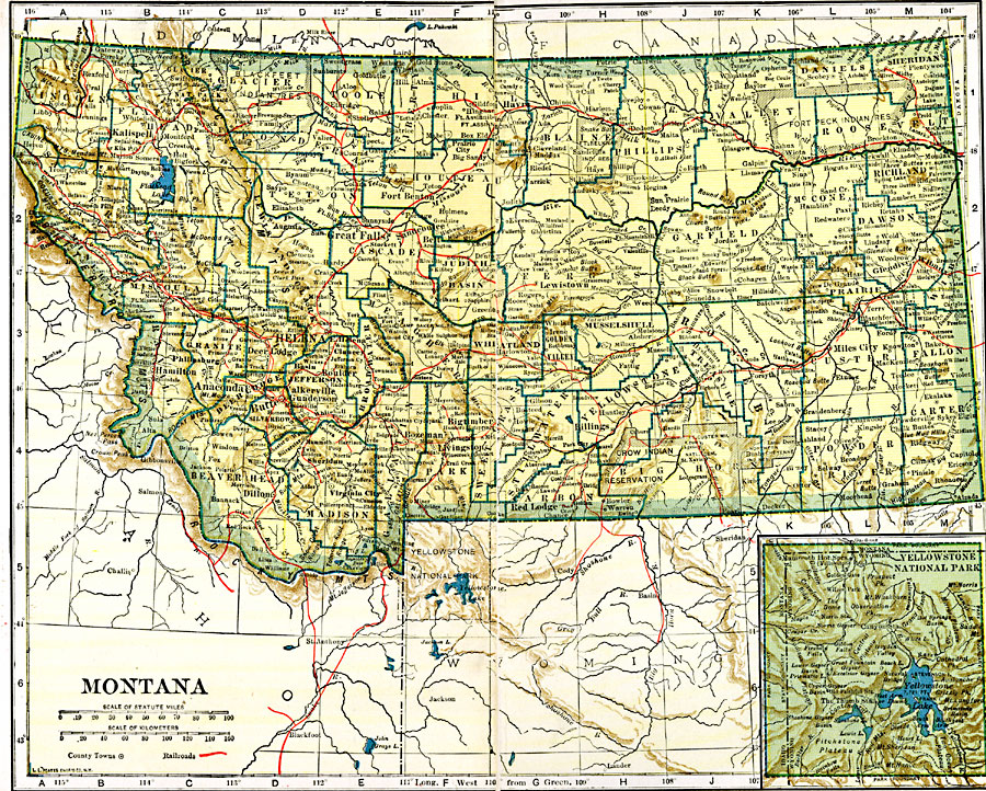
Description: A map from 1919 of Montana showing the capital of Helena, counties and county seats, major cities and towns, Indian reservations, railroads, rivers, and mountains. An inset map details Yellowstone National Park, primarily in Wyoming.
Place Names: Montana, Anaconda, �Bannock, �Billings, �Bozeman, �Butte, �Fort Benton, �Helena, �Livingston, �Missoula, �Virginia Cit
ISO Topic Categories: oceans,
location,
inlandWaters,
transportation
Keywords: Montana, borders, �physical, �railroads, �transportation, kNativeAmerican, country borders,
county borders, railroads, oceans,
location,
inlandWaters,
transportation, Unknown, 1919
Source: L.L. Poates, Poates Complete Atlas of the World (New York, NY: Poates Corporation , 1921) 76-77
Map Credit: Courtesy the private collection of Roy Winkelman |
|