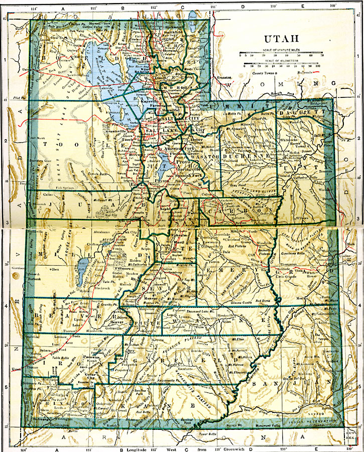
Description: A map from 1919 of Utah showing the capital at Salt Lake City, counties and county seats, principal cities and towns, railroads, mountains, lakes, rivers, and the Great Salt Lake Desert region to the west of Salt Lake.
Place Names: Utah, Brigham, �Corinne, �Deseret, �Eureka, �Murray, �Ogden, �Parowan, �Provo, �Salt Lake City, �St. Georg
ISO Topic Categories: oceans,
location,
inlandWaters,
transportation
Keywords: Utah, borders, �physical, �railroads, �transportation, country borders,
county borders, railroads, oceans,
location,
inlandWaters,
transportation, Unknown, 1919
Source: L.L. Poates, Poates Complete Atlas of the World (New York, NY: Poates Corporation , 1921) 116-117
Map Credit: Courtesy the private collection of Roy Winkelman |
|