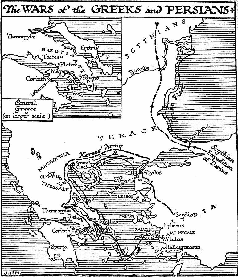
Description: A map of Greece, western Asia Minor, and the &Aelig;gean Sea region during the Greco–Persian Wars (499–479 BC). The map shows the earlier Persian expedition into Scythia under Darius I, which included Ionian allies who sailed from the Bosphorus along the west coast of the Black Sea to the Danube River, the initial Persian invasion under Darius from Samos in Asia Minor to Marathon where his forces were defeated, and the naval and land routes of the second Persian invasion under Xerxes. An inset map details the central Greek areas of Boeotia and Attica, showing the cities of Athens, Corinth, Megara, Egina, Thebes, and Eretria, and the important battle sites of Marathon, Thermopylæ, Platæa, and Salamis.
Place Names: Greece,
ISO Topic Categories: location,
oceans,
inlandWaters,
climatologyMeteorologyAtmosphere,
intelligenceMilitary
Keywords: The Wars of the Greeks and Persians, physical, �transportation, kAncientGreece, physical features, water routes, location,
oceans,
inlandWaters,
climatologyMeteorologyAtmosphere,
intelligenceMilitary, Unknown, 499–448 BC
Source: H. G. Wells, The Outline of History (New York, NY: The Macmillan Company, 1921) 280
Map Credit: Courtesy the private collection of Roy Winkelman |
|