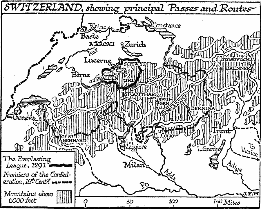
Description: A map of Switzerland, showing the early boundary of The Everlasting League up to 1291, and the frontier of the Swiss Confederacy established by the Federal Charter of 1291. The map shows the principal passes and routes through Switzerland across the Alps to Milan and Venice, including Grand St. Bernard, Simplon, St. Gotthard, Splügen, Bernina, and the Brenner Pass between Innsbruck and Trent (Austria–Italy).
Place Names: Switzerland, Zurich, �Basel, �Bern, �Genev
ISO Topic Categories: boundaries,
location,
inlandWaters,
elevation
Keywords: Switzerland, physical, �political, physical features, major political subdivisions, boundaries,
location,
inlandWaters,
elevation, Unknown, 1291–1599
Source: H. G. Wells, The Outline of History (New York, NY: The Macmillan Company, 1921) 753
Map Credit: Courtesy the private collection of Roy Winkelman |
|