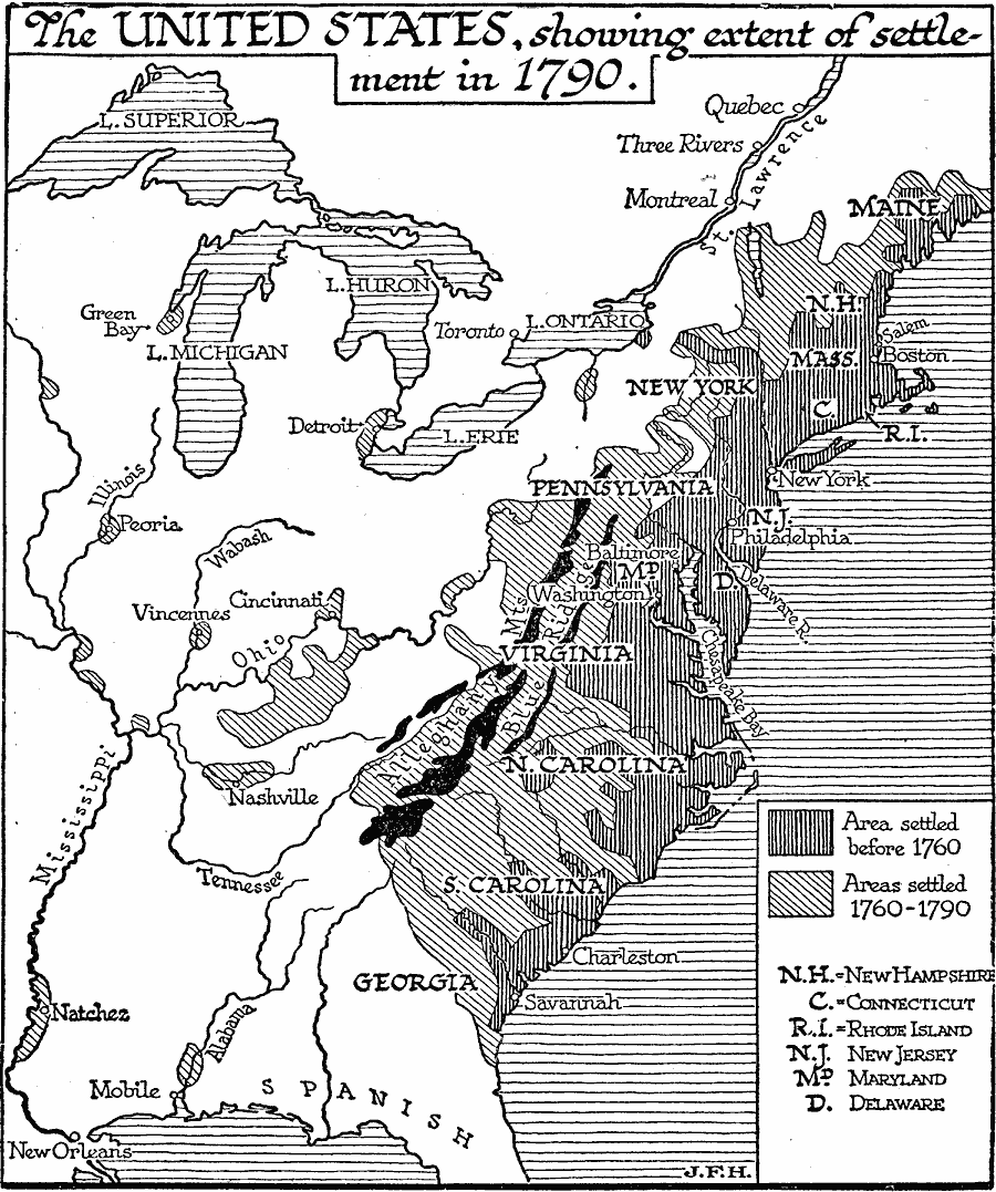
Description: A map of the early United States showing the expansion of settlements by 1790. The map is shading–coded to show the area of settlement before 1760, and between 1760 and 1790, including the areas west of the Alleghany Mountains in the Ohio Valley, Cincinnati, Vincennes, Peoria, Green Bay and Detroit on the Great Lakes, Natchez along the Mississippi River, and Mobile Bay area.
Place Names: Early America 1400-1800, United States, �Canad
ISO Topic Categories: boundaries,
oceans,
location,
inlandWaters
Keywords: The United States, physical, �political, physical features, major political subdivisions, boundaries,
oceans,
location,
inlandWaters, Unknown, 1790
Source: H. G. Wells, The Outline of History (New York, NY: The Macmillan Company, 1921) 841
Map Credit: Courtesy the private collection of Roy Winkelman |
|