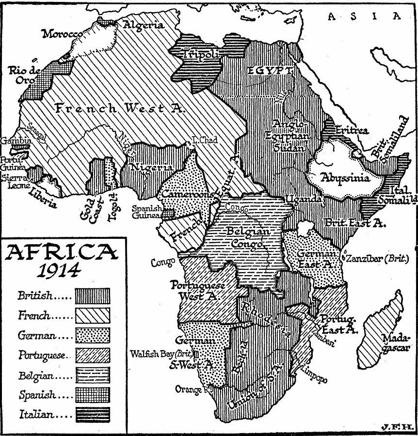
Description: A political sketch map of Africa just prior to WWI in 1914, showing the colonial possessions of European powers established at the Berlin Conference of 1885. The map shows the territorial claims of the British, French, German, Portuguese, Spanish, and Italians.
Place Names: A Complete Map of Africa, French West Africa, �Rio de Oro, �Gambia, �Sierra Leone, �Liberia, �Gold Coast, �Nigeria, �Cameroon, �Congo, �South Africa, �Madagascar, �Egypt, �Tripoli, �Eritea, �Somalia, �Algeri
ISO Topic Categories: boundaries,
inlandWaters,
location,
oceans
Keywords: Africa Prior to WWI, physical, �political, kBerlinConference, physical features, country borders, boundaries,
inlandWaters,
location,
oceans, Unknown, 1914
Source: H. G. Wells, The Outline of History (New York, NY: The Macmillan Company, 1921) 986
Map Credit: Courtesy the private collection of Roy Winkelman |
|