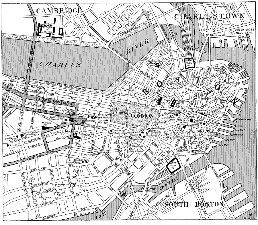
Description: A city plan of central Boston from the Official Automobile Blue Book (1919), showing the Charles River and wharfs, neighboring cities, major roads, bridges, railroads and stations, parks, and major landmarks.
Place Names: Massachusetts, Cambridge, �Boston, �Charlestow
ISO Topic Categories: structure,
location,
inlandWaters,
transportation
Keywords: Boston, physical, �political, �transportation, kAutomobile, physical features, local jurisdictions, railroads,
roads, structure,
location,
inlandWaters,
transportation, Unknown, 1919
Source: The Automobile Blue Book Company, Official Automobile Blue Book 1919 Vol 2 (New York, NY: The Automobile Blue Book Publishing Co., 1919) 414-415
Map Credit: Courtesy the private collection of Roy Winkelman |
|