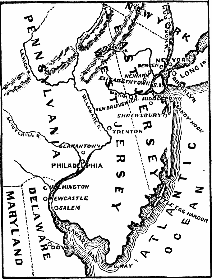
Description: A map of the New Jersey Colony between the establishment of the Dutch settlement at Bergen (1620) and the unification of East and West Jersey in 1702. The map shows the ‘North River’ (Hudson River) and ‘South River’ (Delaware River), the first English settlement of Elizabethtown (1664), the settlements of Newark, Middletown, and Shrewsbury, the division line of the territory into East Jersey and West Jersey in 1676, and the unification under the governor of New York in 1702.
Place Names: Early America 1400-1800, Delaware, �Maryland, �New Jersey, �New York, �Pennsylvania, �Colonial Americ
ISO Topic Categories: oceans,
location,
inlandWaters,
boundaries
Keywords: Middle Colonies, borders, �physical, �historical, �country borders, historical event, oceans,
location,
inlandWaters,
boundaries, Unknown, 1620–1702
Source: David B. Scott, A School History of the United States, from the discovery of America to the year 1880. (New York, NY: American Book Company, 1884) 99
Map Credit: Courtesy the private collection of Roy Winkelman |
|