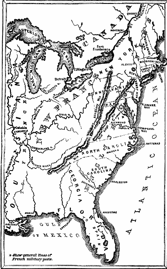
Description: A map of eastern North America in 1750 showing the British colonies, the French possessions of Canada, New France, and Louisiana, and the Spanish possession of Florida. The map shows major settlements of the colonies, the forts in the French territories, St. Augustine in Spanish Florida, mountain systems, lakes, rivers, and coastal features of the region.
Place Names: Early America 1400-1800, Connecticut, �Florida, �Georgia, �Louisiana, �Maryland, �Massachusetts, �New Hampshire, �New Jersey, �New York, �North Carolina, �Pennsylvania, �Rhode Island, �Spanish, �French, �Englis
ISO Topic Categories: oceans,
location,
inlandWaters,
boundaries
Keywords: English, French, and Spanish Occupation, borders, �physical, �historical, �military, �country borders, historical event,
other military, oceans,
location,
inlandWaters,
boundaries, Unknown, 1750
Source: David B. Scott, A School History of the United States, from the discovery of America to the year 1880. (New York, NY: American Book Company, 1884) 124
Map Credit: Courtesy the private collection of Roy Winkelman |
|