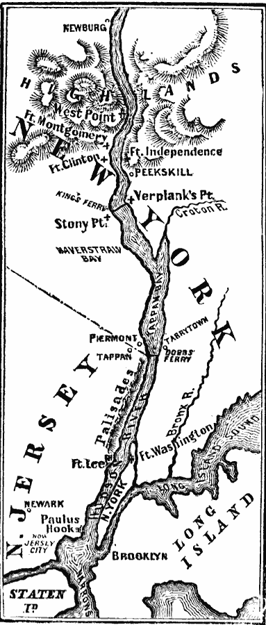
Description: A map of the Hudson River area from Newburg to the Long Island Sound showing the Revolutionary War posts and towns along the river, including West Point, Peekskill, Verplanck's Point, King's Ferry, Stony Point, Haverstraw Bay, Tarrytown, Dobbs Ferry, Piermont, Tappan, Newark, Paulus Hook (Jersey City), New York, Brooklyn, and the forts Montgomery, Clinton, Independence, Lee, and Washington.
Place Names: Early America 1400-1800, Brooklyn, �Ft. Lee, �Ft. Washington, �Long Island, �Newark, �New Jersey, �New York, �Peekskill, �American Revolutio
ISO Topic Categories: oceans,
location,
inlandWaters
Keywords: The Hudson River – Newburg to New York, American Revolution, �physical, �historical, �military, �war, kAmericanRevolution, country borders, historical event,
American Revolution, oceans,
location,
inlandWaters, Unknown, 1779
Source: David B. Scott, A School History of the United States, from the discovery of America to the year 1880. (New York, NY: American Book Company, 1884) 198
Map Credit: Courtesy the private collection of Roy Winkelman |
|