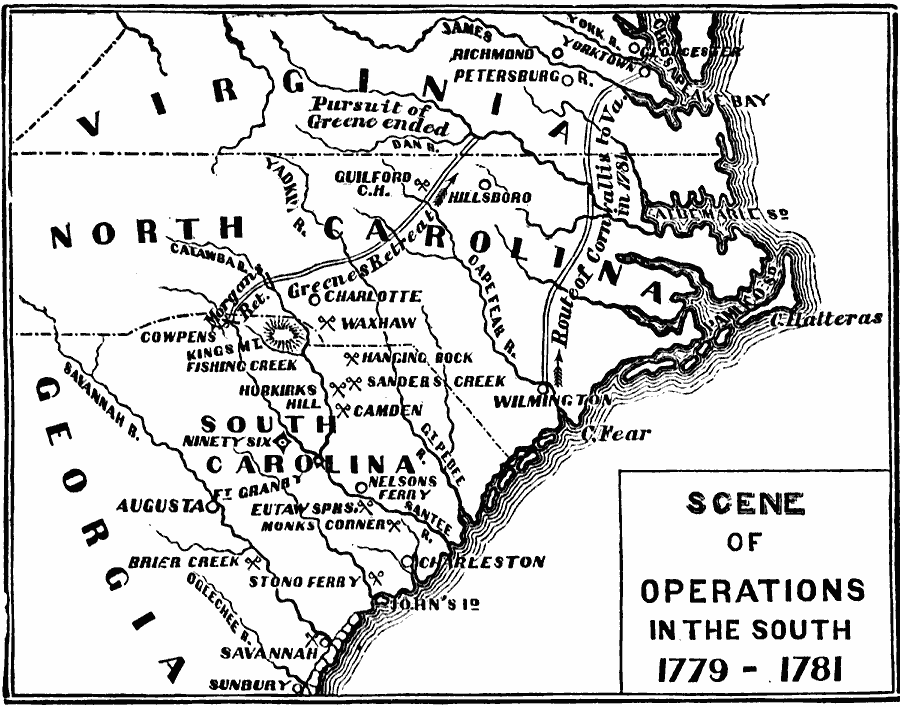
Description: A map of southern Virginia, North Carolina, South Carolina, and Georgia showing the scene of operations in the South during the American Revolutionary War from 1779—1781. The map shows the route of Greene's retreat from Cowpens to the Dan River, Cornwallis' march from Wilmington to Yorktown, and the battle sites of Guilford Court House, Waxhaw, Hanging Rock, Sanders Creek, Hobkirk's Hill, Camden, Eutaw Springs, Monk's Corner, Brier Creek, Stono Ferry, and Savannah.
Place Names: Early America 1400-1800, Georgia, �North Carolina, �South Carolina, �Virginia, �American Revolutio
ISO Topic Categories: oceans,
location,
inlandWaters
Keywords: Scene of Operations in the South, American Revolution, �physical, �historical, �military, �war, kAmericanRevolution, country borders, historical event,
American Revolution, oceans,
location,
inlandWaters, Unknown, 1779–1781
Source: David B. Scott, A School History of the United States, from the discovery of America to the year 1880. (New York, NY: American Book Company, 1884) 212
Map Credit: Courtesy the private collection of Roy Winkelman |
|