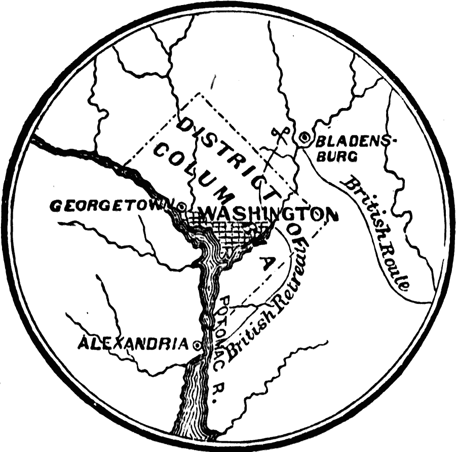
Description: A sketch map of Washington and the District of Columbia during the War of 1812 when British forces occupied and burned the public buildings in the city (August, 1814). The map shows the British advance on the city after the Battle of Bladensburg, and their line of retreat to the Potomac River near Alexandria.
Place Names: District of Columbia, Alexandria, �Chesapeake Bay, �Georgetown, �Virginia, �Washington, �Washington D.C
ISO Topic Categories: oceans,
location,
inlandWaters
Keywords: Vicinity of Washington, physical, �historical, �military, �war, �country borders, historical event, oceans,
location,
inlandWaters, Unknown, 1814
Source: David B. Scott, A School History of the United States, from the discovery of America to the year 1880. (New York, NY: American Book Company, 1884) 264
Map Credit: Courtesy the private collection of Roy Winkelman |
|