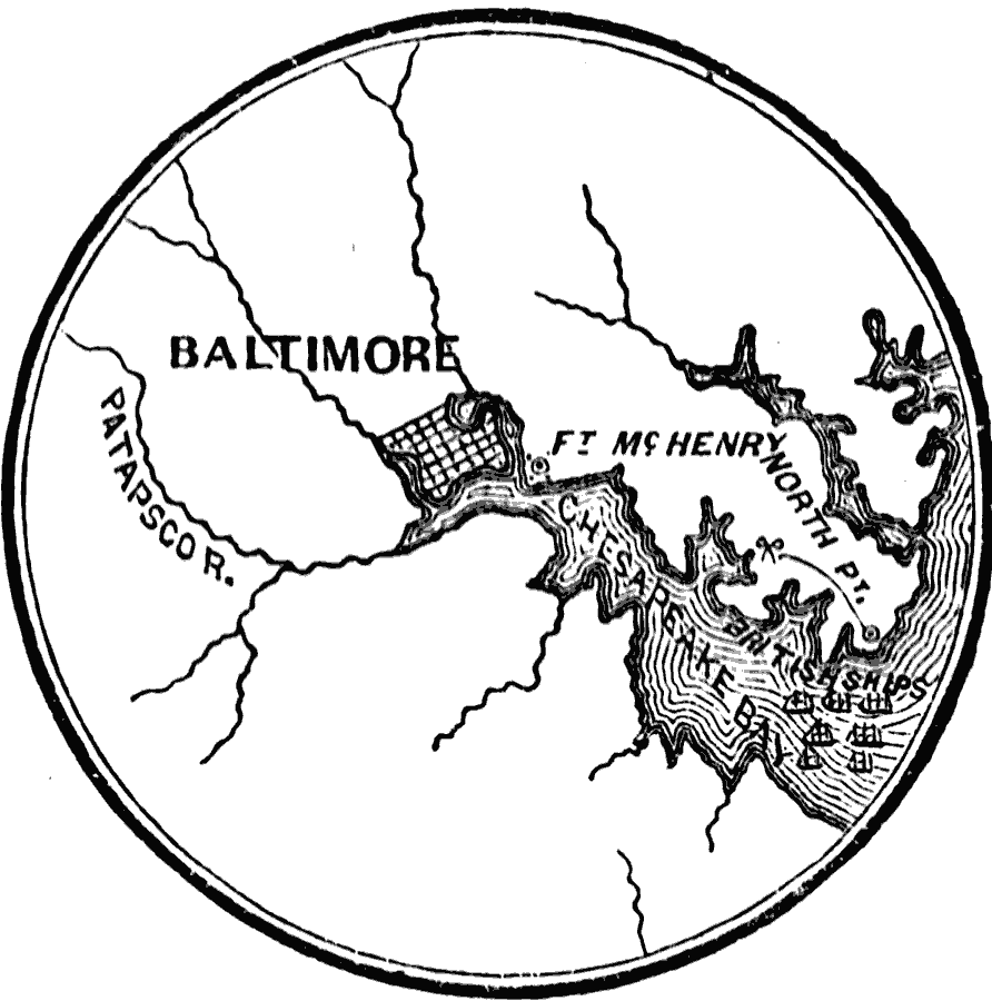
Description: A sketch map of the vicinity of Baltimore during the War of 1812 showing British movements after the burning of Washington in August, 1814. The map shows the Patapsco River and Chesapeake Bay, the British fleet position in the bay, the landing site of North Point and the site of the Battle of North Point five miles to the north, and the American Fort McHenry (defense of this fort inspired Francis Scott Key to write the ‘Star–Spangled Banner’).
Place Names: Maryland, Baltimor
ISO Topic Categories: oceans,
location,
inlandWaters
Keywords: Vicinity of Baltimore, physical, �historical, �military, �war, �country borders, historical event, oceans,
location,
inlandWaters, Unknown, 1814
Source: David B. Scott, A School History of the United States, from the discovery of America to the year 1880. (New York, NY: American Book Company, 1884) 265
Map Credit: Courtesy the private collection of Roy Winkelman |
|