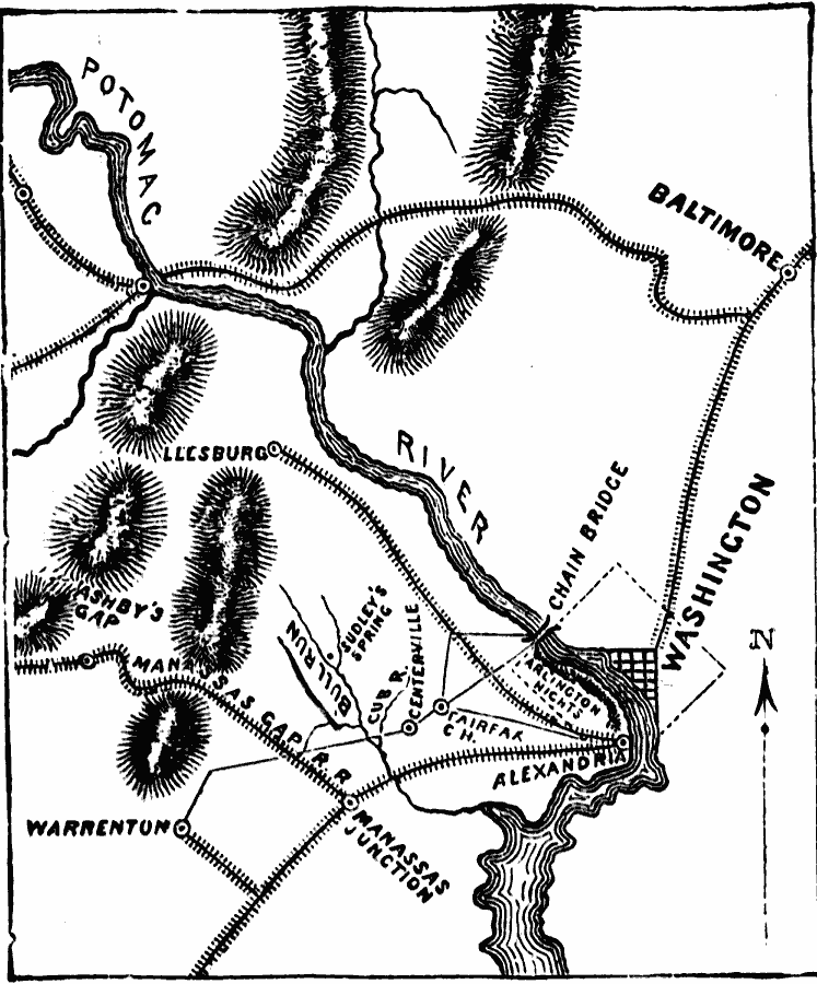
Description: A map showing the battle site of the First Battle of Bull Run or Battle of Manassas, and its proximity to Washington DC. The map shows the railroads in the area, Manassas Junction, Centerville, Bull Run Creek, the Warrenton Turnpike, Sudley Spring, and Alexandria.
Place Names: Civil War, Alexandria, �Baltimore, �Leesburg, �Manassas, �Warrento
ISO Topic Categories: oceans,
location,
inlandWaters
Keywords: The First Battle of Bull Run, physical, �historical, �military, �war, �country borders, historical event, oceans,
location,
inlandWaters, Unknown, 1861
Source: David B. Scott, A School History of the United States, from the discovery of America to the year 1880. (New York, NY: American Book Company, 1884) 326
Map Credit: Courtesy the private collection of Roy Winkelman |
|