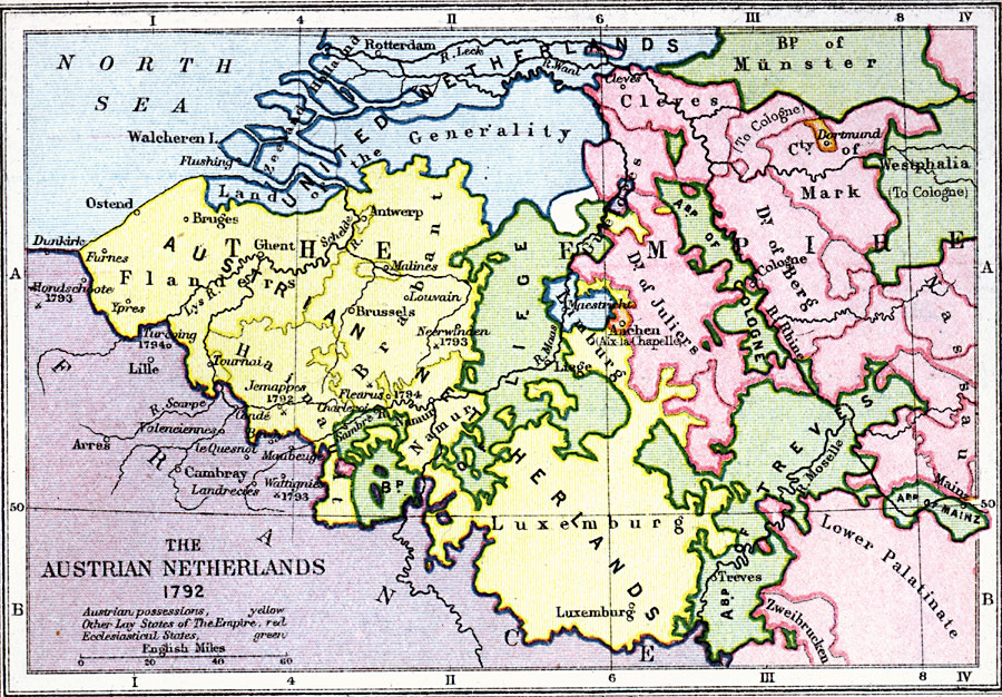
Description: A map of the Austrian Netherlands in 1792 at the onset of the French Revolutionary Wars. The map is color–coded to show the territories under Austrian possession, the Ecclesiastical States of the Holy Roman Empire, the United Netherlands, and other lay–states of the Empire. The map shows major cities, towns, and ports, rivers, and coastal features of the region. Significant battle sites of the revolutionary war are shown.
Place Names: Netherlands, Bruges, �Ghent, �Antwerp, �Brussels, �Namur, �Luxemburg, �Treves, �Aachen, �Liege, �Dortmund, �Ypres, �Furnes, �Ostend, �Rotterda
ISO Topic Categories: inlandWaters,
location,
boundaries,
oceans
Keywords: Austrian Netherlands, physical, �political, �austrian netherlands in 1792, austrian possessions, other lay states of the empire, ecclesiastical states, physical features, country borders,
major political subdivisions, inlandWaters,
location,
boundaries,
oceans, Unknown, 1792
Source: Samuel Rawson Gardiner D.C.L., L.L.D., School Atlas of English History (London, England: Longmans, Green, and Co., 1914) 52
Map Credit: Courtesy the private collection of Roy Winkelman |
|