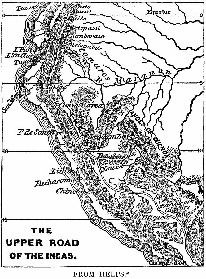
Description: A map from 1889 of the Upper Road of the Incas. The map shows the route of the main Inca Road (Camino Real) from the north of Quito near Pasto, Columbia, south to Cloiquisaca. The route shows the Incan capital of Cuzco and many settlements. "Excellent roads for foot passengers radiated from Cuzco to the remotest portions of the empire. The Inca roads were level and well paved, and continued for hundreds of leagues. Rocks were broken up and leveled when it was necessary, ravines were filled, and excavations were made in mountain sides. [...] The Inca himself travelled in a litter, borne by mountaineers from the districts of Soras and Lucanas. Corpa-huasi, or rest-houses, were erected at intervals, and the government messengers, or chasquis, ran with wonderful celerity from one of these stations to another, where he delivered his message, or quipu, to the next runner. Thus news was brought to the central government from all parts of the empire with extraordinary rapidity, and the Incas ate fresh fish at Cuzco which had been caught in the Pacific, three hundred miles away, on the previous day. Storehouses, with arms, clothing, and provisions for the soldiers, were also built at intervals along the roads, so that an army could be concentrated at any point without previous preparation." — Winsor, 1889, pp. 254-255.
Place Names: A Regional Map of South America, Peru, �Lake Titicaca, �Andes Mountain
ISO Topic Categories: transportation,
location,
inlandWaters,
oceans
Keywords: Upper Road of the Incas, physical, �transportation, physical features, roads, transportation,
location,
inlandWaters,
oceans, Unknown, 1438–1543
Source: Justin Winsor, Narrative and Critical History of America Vol 1 (New York, NY: Houghton, Mifflin, and Company, 1889) 254
Map Credit: Courtesy the private collection of Roy Winkelman |
|