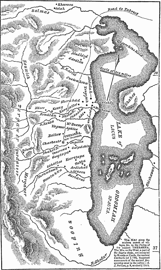
Description: A map of the valley of the ancient Thebarma, located in West Azerbaijan Province in Iran. This map gives the modern names of villages in the valley. The mountains on the west are a part of the Zagros chain, and are occupied by Kurds. &In the western part of this province was the Lacus Spauta or Marcianus (lake of Oroomiah), near on which on its western side was Thebarma (Oroomiah), said to be the native place of Zoroaster or Zerdusht." — Fiske, 1854, p. 44.
Place Names: Iran,
ISO Topic Categories: location,
inlandWaters,
transportation
Keywords: Valley of Thebarma, transportation, �physical, physical features, roads, location,
inlandWaters,
transportation, Unknown, 1854
Source: N. W. Fiske, Manual of Classical Literature (Philadelphia, PA: E. C. & J. Biddle, 1854) 45
Map Credit: Courtesy the private collection of Roy Winkelman |
|