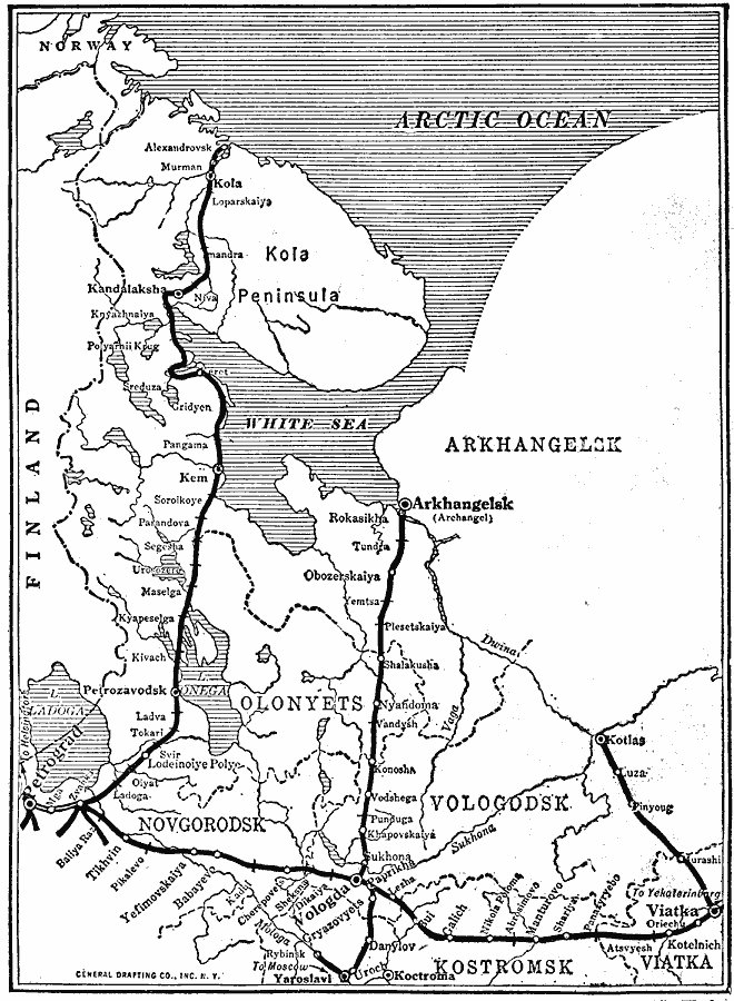
Description: A map from 1920 of the Murman (Murmansk) Coast and Archangel (Arkhangelsk) during World War I. The map covers the area from the Kola Peninsula on the Arctic Ocean south to Petrograd (St. Petersburg), Yaroslavl, and Viatka. The map shows the railways in the area and railway depots, including the route to Archangel on the White Sea, and to Kola, and Murman, the important Russian ice–free port on the Arctic Ocean. During the war, the port of Murman was a vital supply link to the Eastern Front, and an Allied expedition of the British, French, and American troops held the Murman Coast and part of the railroad line south of it, chiefly to prevent its use as a naval and commercial outlet by Germany.
Place Names: Russia, Archangel, �Arkhangels
ISO Topic Categories: inlandWaters,
location,
oceans,
transportation,
intelligenceMilitary
Keywords: The Murman Coast and Archangel, physical, �transportation, physical features, railroads, WWI, inlandWaters,
location,
oceans,
transportation,
intelligenceMilitary, Unknown, 1918
Source: Willis J. Abbot, The United States in the Great War (New York, NY: Leslie-Judge Co., 1920) 169
Map Credit: Courtesy the private collection of Roy Winkelman |
|
