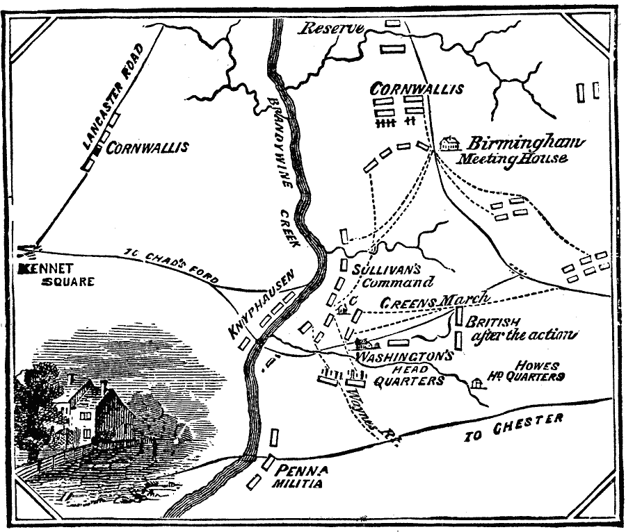
Description: A map of the area in Pennsylvania south of Philadelphia detailing the Battle of Brandywine during the American Revolution (September 11, 1777). The map shows the battle site of Chad's Ford, the Lancaster Road, the British and American positions, the headquarters of Washington at the onset of the battle and British commander Howe at the end, and the routes of Green's march and Sullivan's command during the battle.
Place Names: Early America 1400-1800, American Revolutio
ISO Topic Categories: intelligenceMilitary,
inlandWaters,
location,
transportation
Keywords: Battle at the Brandywine, transportation, �historical, �physical, �political, kAmericanRevolution, kBattle, physical features, local jurisdictions, roads, American Revolution, intelligenceMilitary,
inlandWaters,
location,
transportation, Unknown, 1777
Source: Frank Gilbert, The World: Historical and Actual (Chicago, IL: National Library Association, 1892) 511
Map Credit: Courtesy the private collection of Roy Winkelman |
|