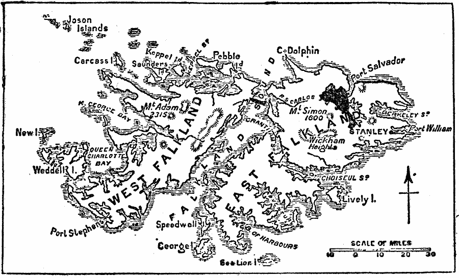
Description: A map from 1903 of the Falkland Islands, located in the South Atlantic off the coast of Argentina and under control of Great Britain. The map shows the capital city of Stanley and the settlements of Port Salvador and Port William, the mountains Simon on the East Island and Adam on the West Island, Wickham Heights, and the numerous islets, bays, and sounds of the island group.
Place Names: A Regional Map of South America, Falkland Island
ISO Topic Categories: location,
oceans,
inlandWaters
Keywords: The Falkland Islands, physical, physical features, location,
oceans,
inlandWaters, Unknown, 1903
Source: Day Otis Kellogg, The Encyclopedia Britannica Vol 9 (New York, NY: The Werner Company, 1903) 14
Map Credit: Courtesy the private collection of Roy Winkelman |
|