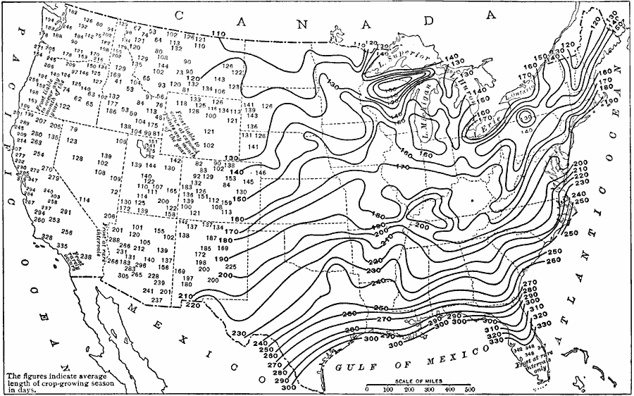
Description: A map from 1916 of the United States showing the average number of days during the year in which crops can grow in the different parts of the country. The lines on the map mark places that have about the same number of crop–growing days, and the figures indicate the average number of days. The map illustrates the local variables in crop–growing days in the region west of the Rocky Mountains, in the Great Basin, and along the Pacific coast, and notes frost probability in the west and southern Florida.
Place Names: Agriculture,
ISO Topic Categories: boundaries,
farming,
location,
oceans,
inlandWaters
Keywords: Crop Growing Season, physical, �statistical, �political, kAgriculture, kClimate, physical features, country borders,
major political subdivisions, agriculture, boundaries,
farming,
location,
oceans,
inlandWaters, Unknown, 1916
Source: Albert Perry Brigham & Charles T. McFarlane, Essentials of Geography (New York, NY: American Book Company, 1916) 42
Map Credit: Courtesy the private collection of Roy Winkelman |
|