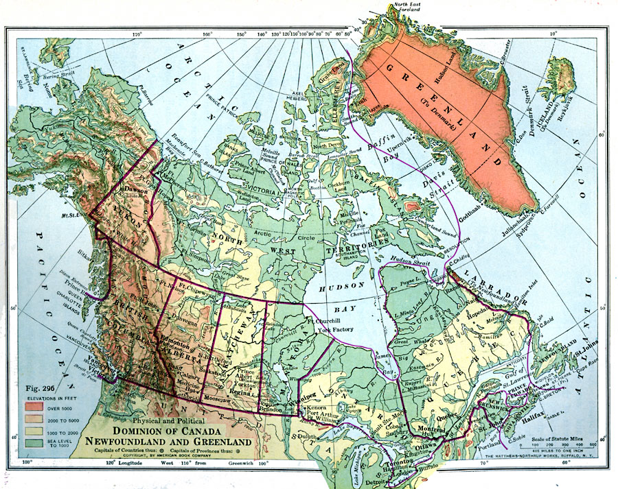
Description: A map from 1916 of the Dominion of Canada, Newfoundland (Newfoundland and Labrador were not part of the Canadian Confederation until 1949), Greenland, and Iceland. This map uses color–contouring to show general land elevations from sea level to above 5000 feet, indicating mountain systems, highlands, and plains. The map shows capitals, provincial capitals, major cities and towns, foreign possessions (Saint Pierre and Miquelon, Greenland, and Iceland), political boundaries, terrain, lakes, rivers, coastal features, and islands in the region.
Place Names: Canada, Toronto, �Quebec, �Ottawa, �Winnipeg, �Calgary, �Edmonton, �Vancouver, �Victoria, �Montrea
ISO Topic Categories: boundaries,
oceans,
location,
inlandWaters
Keywords: Dominion of Canada, Newfoundland, and Greenland, physical, �political, physical features, country borders,
major political subdivisions, boundaries,
oceans,
location,
inlandWaters, Unknown, 1916
Source: Albert Perry Brigham & Charles T. McFarlane, Essentials of Geography (New York, NY: American Book Company, 1916) 189
Map Credit: Courtesy the private collection of Roy Winkelman |
|