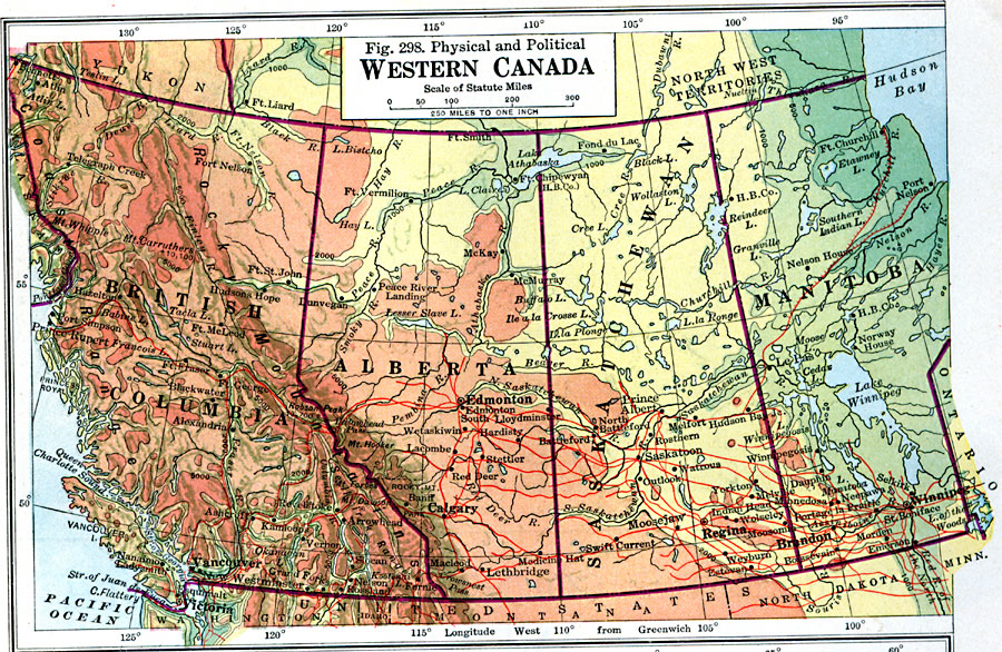
Description: A map from 1916 of western Canada (British Columbia, Alberta, Saskatchewan, and Manitoba) from the Pacific coastline east to the Ontario border, and from approximately latitude 60° North to the International boundary with the United States. This map uses color–contouring to show land elevations from sea level to above 5,000 feet, and includes the summit elevations for prominent peaks. The map shows province boundaries and capitals, major cities and towns, existing and proposed railways, rivers, lakes, and prominent terrain and coastal features.
Place Names: Canada, Edmonton, �Calgary, �Winnipeg, �Vancouver, �Victori
ISO Topic Categories: boundaries,
location,
oceans,
transportation,
inlandWaters
Keywords: Western Canada, physical, �political, �transportation, physical features, country borders,
major political subdivisions, railroads, boundaries,
location,
oceans,
transportation,
inlandWaters, Unknown, 1916
Source: Albert Perry Brigham & Charles T. McFarlane, Essentials of Geography (New York, NY: American Book Company, 1916) 200
Map Credit: Courtesy the private collection of Roy Winkelman |
|