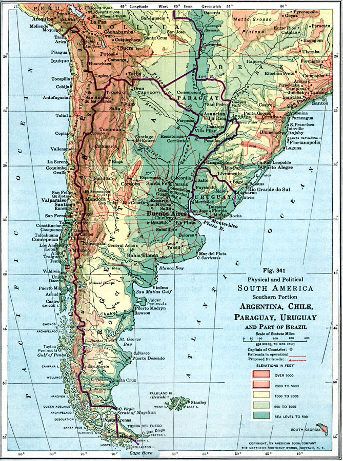
Description: A physical and political map from 1916 of southern South America, showing the political boundaries of Argentina, Chile, Paraguay, Uruguay, and part of Brazil at the time. The map uses color–contouring to show elevations from sea level to above 5000 feet, and shows capitals and major cities, existing and proposed railroads, rivers, lakes, terrain, and coastal features of the region.
Place Names: A Regional Map of South America, Argentina, �Chile, �Uraguay, �Paraguay, �Brazi
ISO Topic Categories: boundaries,
location,
oceans,
inlandWaters,
transportation,
planningCadastre
Keywords: Physical and Political Map of Southern South America, physical, �political, �transportation, physical features, country borders, railroads, boundaries,
location,
oceans,
inlandWaters,
transportation,
planningCadastre, Unknown, 1916
Source: Albert Perry Brigham & Charles T. McFarlane, Essentials of Geography (New York, NY: American Book Company, 1916) 232
Map Credit: Courtesy the private collection of Roy Winkelman |
|