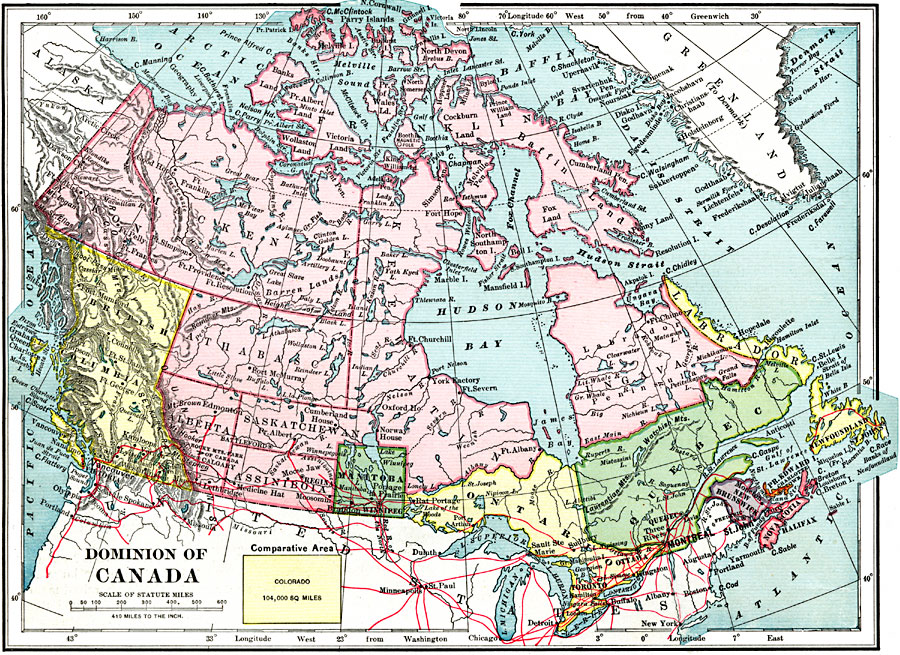
Description: A map from 1899 of the Dominion of Canada and Newfoundland (Newfoundland and Labrador were not part of the Canadian Confederation until 1949), showing the provinces at the time, provincial capitals, major cities, towns, and settlements, railways, mountain systems, lakes, rivers, coastal features, and islands of the region. The provinces and territories shown include Newfoundland and Labrador, Quebec, Ontario, New Brunswick, Prince Edward Island, Nova Scotia, Manitoba, Saskatchewan, Assinboia, Alberta, British Columbia, Athabasca, Keewatin, Ungava, Franklin, Mackenzie, and Yukon. An outline map of Colorado at the same map scale shows comparative area size.
Place Names: Canada, Calgary, �Churchill, �Edmonton, �Montreal, �Ottawa, �Quebec, �Toronto, �Vancouver, �Victoria, �Winnipe
ISO Topic Categories: oceans,
inlandWaters,
location
Keywords: The Dominion of Canada, borders, �topographical, �physical, kComparativeArea, physical features,
topographical, country borders, oceans,
inlandWaters,
location, Unknown, 1899
Source: Horace S. Tarbell, LL.D. , The Complete Geography (New York, NY: American Book Company, 1899) 66
Map Credit: Courtesy the private collection of Roy Winkelman |
|