mapsMaps ETC Site map
 Maps ETC > Africa > A Complete Map of Africa > Comparative size of Africa and the United States, 1899
Site Map 

Comparative size of Africa and the United States, 1899

Comparative size of Africa and the United States


Title: Comparative size of Africa and the United States
Projection: Unknown,
Source Bounding Coordinates:
W: E: N: S:

Main Map Page
Zoomify Version
B/W PDF Version
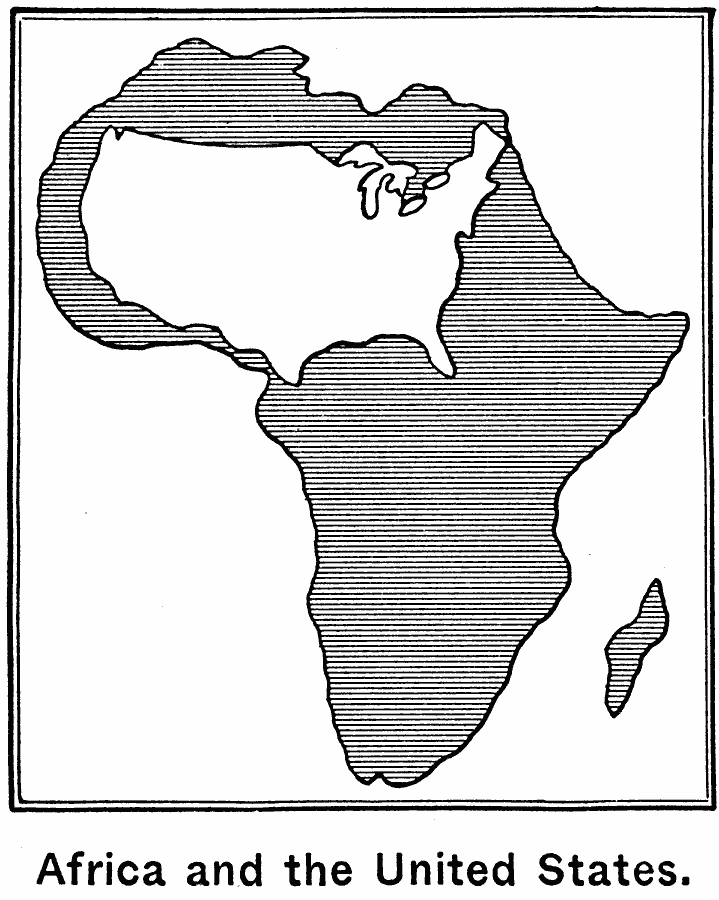
Description: Map illustrates the size of Africa by superimposing the United States over it.
Place Names: A Complete Map of Africa, Africa, United State
ISO Topic Categories: oceans, inlandWaters, location
Keywords: Comparative size of Africa and the United States, physical, kComparativeArea, physical features, oceans, inlandWaters, location, Unknown, 1899
Source: Horace S. Tarbell, LL.D. , The Complete Geography (New York, NY: American Book Company, 1899) 119
Map Credit: Courtesy the private collection of Roy Winkelman
SearchLicensePDF HelpGIS Help Google Earth Help Zoomify Help

 Maps ETC > Africa > A Complete Map of Africa > Comparative size of Africa and the United States, 1899
Site Map