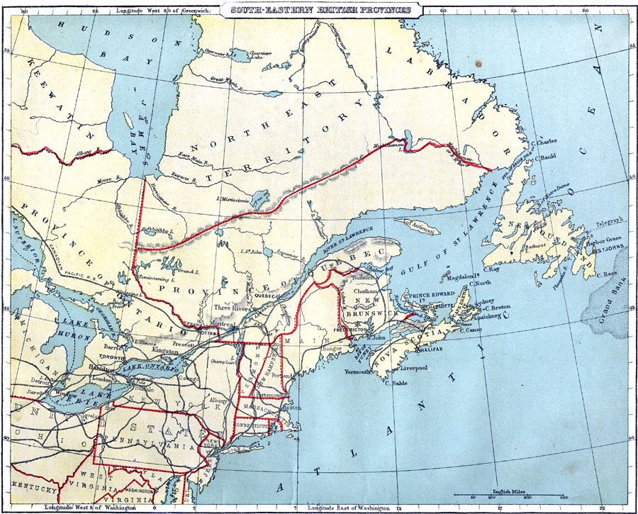
Description: A map from 1888 of the southeastern provinces of British America (Dominion of Canada). The map shows the province boundaries of Keewatin to the west of Hudson Bay, North East Territory to the east of Hudson Bay, the eastern part of Ontario, and the provinces of Quebec, New Brunswick, Prince Edward Island, and Nova Scotia. Newfoundland and Labrador were at the time a separate colony, and not part of the Dominion of Canada.
Place Names: Canada, Northeast Territory, �Labrador, �Newfoundland, �Nova Scotia, �New Brunswick, �Province of Quebec, �Province of Ontario, �Keewati
ISO Topic Categories: boundaries,
inlandWaters,
location,
oceans,
transportation
Keywords: Southeastern British Provinces, physical, �political, �transportation, physical features, country borders,
major political subdivisions, railroads, boundaries,
inlandWaters,
location,
oceans,
transportation, Unknown, 1888
Source: , Cornell's Intermediate Geography (New York, NY: American Book Company, 1888) 18
Map Credit: Courtesy the private collection of Roy Winkelman |
|