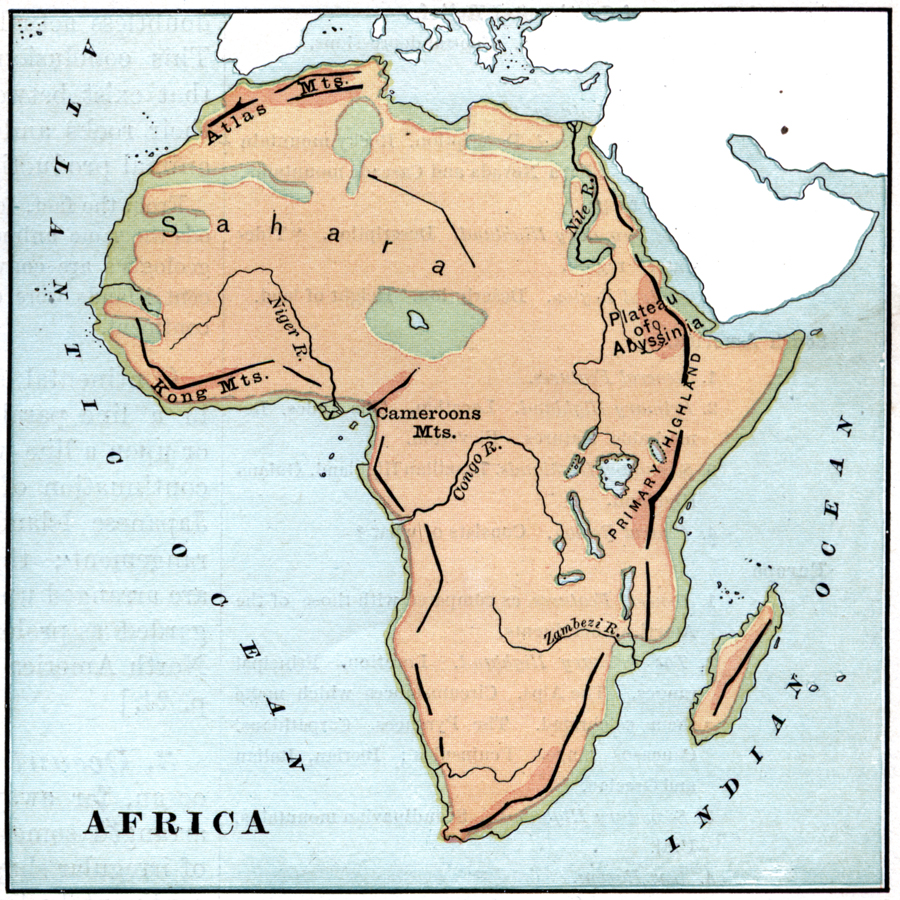
Description: An orographic relief map of Africa showing the major mountain systems and highlands of the African continent, including the Atlas Mountains, Plateau of Abyssinia, Kong Mountains, and Cameroon Mountains. This map also shows the major river systems.
Place Names: A Complete Map of Africa, Atlas Mountains, �Kong Mountains, �Cameroons Mountains, �Primary Highlan
ISO Topic Categories: elevation,
inlandWaters,
oceans
Keywords: Mountain Systems of Africa, physical, physical features,
topographical, elevation,
inlandWaters,
oceans, Unknown, 1885
Source: M. F. Maury, Physical Geography (New York, New York: University Publishing Company, 1885) 37
Map Credit: Courtesy the private collection of Roy Winkelman |
|