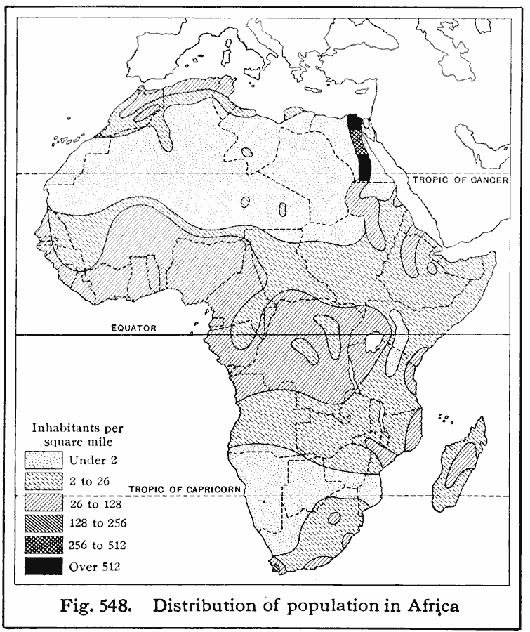
Description: A map showing the population density of Africa in 1916 showing density ranges from under 2 inhabitants to areas along the Nile River valley and delta of more than 512 inhabitants per square mile.
Place Names: A Complete Map of Africa, Nile River Vall
ISO Topic Categories: boundaries,
location,
oceans,
inlandWaters,
society
Keywords: Population Density in Africa, physical, �political, �statistical, kPopulation, physical features, country borders, population, boundaries,
location,
oceans,
inlandWaters,
society, Unknown, 1916
Source: Albert Perry Brigham & Charles T. McFarlane, Essentials of Geography (New York, NY: American Book Company, 1916) 375
Map Credit: Courtesy the private collection of Roy Winkelman |
|