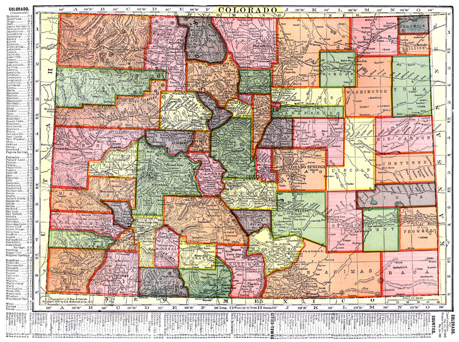
Description: A map from 1911 of Colorado showing the State capital of Denver, counties and county seats, major cities and towns, railroads, the Rockies and other mountain systems, lakes, and rivers. A grid reference in the margins of the map lists counties, principal cities, and towns of Colorado.
Place Names: Colorado, Aspen, �Leadville, �Denver, �Colorado Springs, �Georgetown, �Puebl
ISO Topic Categories: boundaries,
transportation,
inlandWaters,
location
Keywords: Colorado, physical, �political, �transportation, physical features, major political subdivisions,
county borders, railroads, boundaries,
transportation,
inlandWaters,
location, Unknown, 1911
Source: C. S. Hammond, Hammond's Pictorial Atlas of the World (New York, NY: C. S. Hammond & Company, 1911) 117
Map Credit: Courtesy the private collection of Roy Winkelman |
|