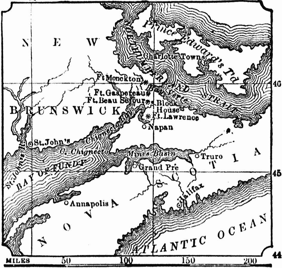
Description: A map of New Brunswick and Nova Scotia in 1775, when it was known as Acadia. Acadia had been ceded by France to the British under the Treaty of Utrecht (1713). At the outbreak of the French and Indian War, the British began a campaign of expelling the former French settlers, resulting in the forced deportation of the Acadians. This map shows the area, French forts, and settlements during the British campaign of Colonel Monckton in 1775, including Bay Verte (Green Bay), the eastern shore of Chignecto at the head of the Bay of Fundy, Fort Lawrence, the French block–house and Fort Beau Sejour (then changed to Cumberland by the British), Fort Gaspereau, and Fort Monckton.
Place Names: Canada, Napan, �Block, �Ft. Beau, �Halifa
ISO Topic Categories: inlandWaters,
location,
oceans
Keywords: The Acadian Peninsula, physical, physical features, inlandWaters,
location,
oceans, Unknown, 1775
Source: W. H. De Puy, People's Cyclopedia of Universal Knowledge Vol 1 (New York, NY: Phillips & Hunt, 1881) 24
Map Credit: Courtesy the private collection of Roy Winkelman |
|