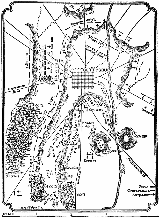
Description: A plan of the Battle of Gettysburg, which took place between July 1—3, 1863. The map shows Union and Confederate positions, artillery positions, roads, and terrain features.
Place Names: Civil War, Gettysbur
ISO Topic Categories: intelligenceMilitary,
inlandWaters,
location,
transportation
Keywords: Battle of Gettysburg, physical, �political, �transportation, �historical, kBattle, physical features, local jurisdictions, roads, Civil War, intelligenceMilitary,
inlandWaters,
location,
transportation, Unknown, 1863
Source: W. H. De Puy, People's Cyclopedia of Universal Knowledge Vol 1 (New York, NY: Phillips & Hunt, 1881) 801
Map Credit: Courtesy the private collection of Roy Winkelman |
|