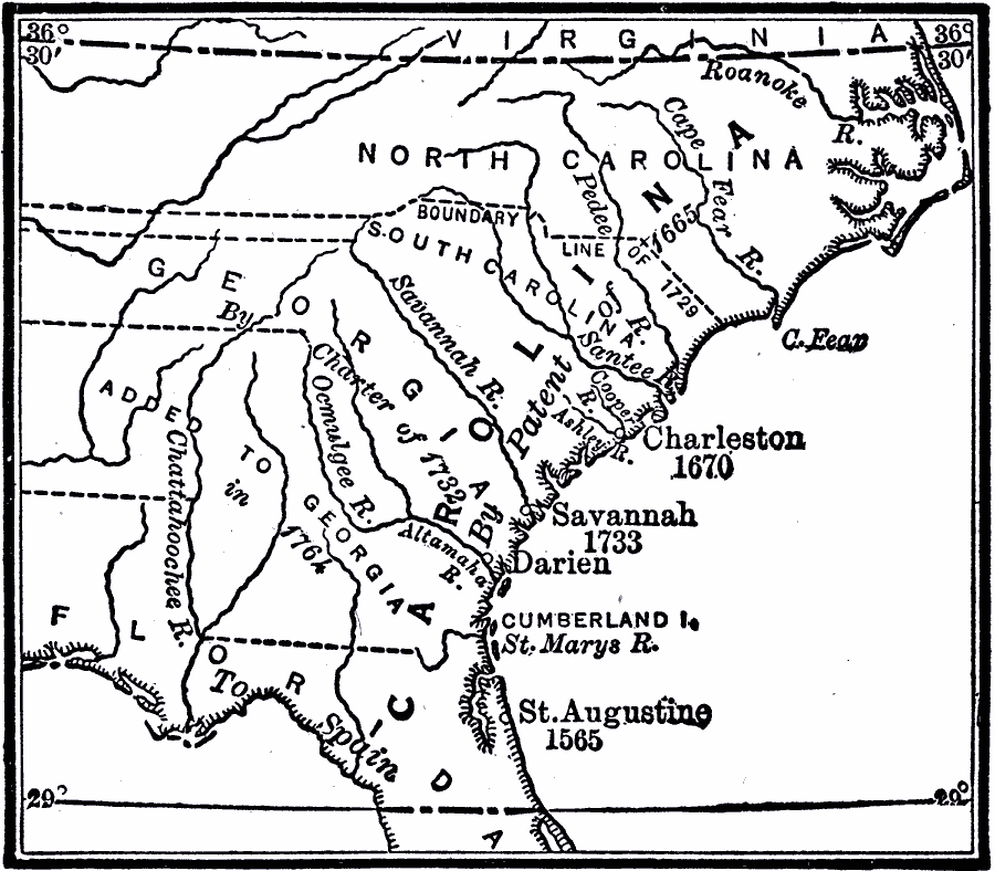
Description: A map showing the development of the Carolinas from the land grant of Charles II in 1663 to the establishment of the Province of Georgia by charter in 1732. The map shows the area of Carolina as established by the Patent of 1665 extending from 36° 30’ N to 29° N in Florida, the Spanish post of St. Augustine (1565), the settlement of Charleston (1670), the division and border between North and South Carolina established in 1729, the establishment of the Province of Georgia under charter by King George II in 1732, and the settlement of Savannah in 1733. Spain regained possession of Florida after the American Revolutionary War by the Treaty of Versailles (1783).
Place Names: Early America 1400-1800, Carolina, �Georgia, �South Carolina, �North Carolina, �Virginia, �Savannah, �Charleston, �Colonial America, �Englis
ISO Topic Categories: boundaries,
inlandWaters,
location,
oceans
Keywords: Development of Early Carolina, physical, �political, physical features, major political subdivisions, boundaries,
inlandWaters,
location,
oceans, Unknown, 1663–1732
Source: Robert Hall, Harriet Smither, and Clarence Ousley, A History of the United States (Dallas, TX: The Southern Publishing Company, 1920) 85
Map Credit: Courtesy the private collection of Roy Winkelman |
|