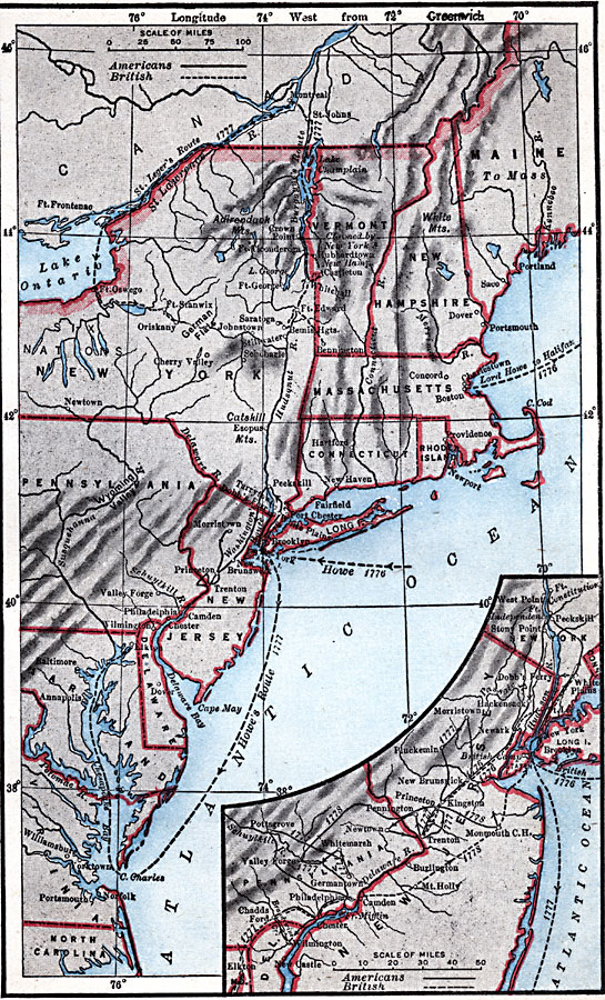
Description: A map of the region involved in major northern campaigns of the American Revolutionary War. The map shows cities, towns, and forts, rivers and terrain features, and is keyed to show British and American routes during the campaigns. An inset map details the area of the New York and New Jersey campaigns and Philadelphia.
Place Names: Early America 1400-1800, Boston, �Rhode Island, �Brooklyn, �New York, �Hartford, �Maine, �American Revolutio
ISO Topic Categories: transportation,
inlandWaters,
location,
oceans,
boundaries
Keywords: American Revolutionary War Campaigns in the North, historical, �physical, �political, �transportation, kAmericanRevolution, physical features, major political subdivisions, water routes, American Revolution, transportation,
inlandWaters,
location,
oceans,
boundaries, Unknown, 1775–1783
Source: Robert Hall, Harriet Smither, and Clarence Ousley, A History of the United States (Dallas, TX: The Southern Publishing Company, 1920) 149
Map Credit: Courtesy the private collection of Roy Winkelman |
|