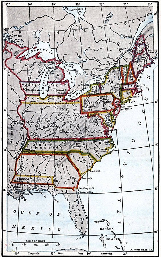
Description: A map of the United States at the close of the American Revolutionary War (1783) showing the newly formed States, and their claims to the lands west of the Allegheny Mountains to the Mississippi River. The map notes the disputed territories north of the Ohio River, and the disputed claims in northern Massachusetts (Maine) and northern West Florida.
Place Names: Early America 1400-1800, East Florida, �West Florida, �North Carolina, �South Carolina, �Virginia, �Pennsylvania, �New Jersey, �Massachusetts, �Connecticut, �Rhode Island, �New Hampshire, �Vermont, �Maine, ��American Revolutio
ISO Topic Categories: boundaries,
oceans,
location,
inlandWaters
Keywords: United States at the Close of the Revolution, physical, �political, physical features, major political subdivisions, boundaries,
oceans,
location,
inlandWaters, Unknown, 1783
Source: Robert Hall, Harriet Smither, and Clarence Ousley, A History of the United States (Dallas, TX: The Southern Publishing Company, 1920) 173
Map Credit: Courtesy the private collection of Roy Winkelman |
|