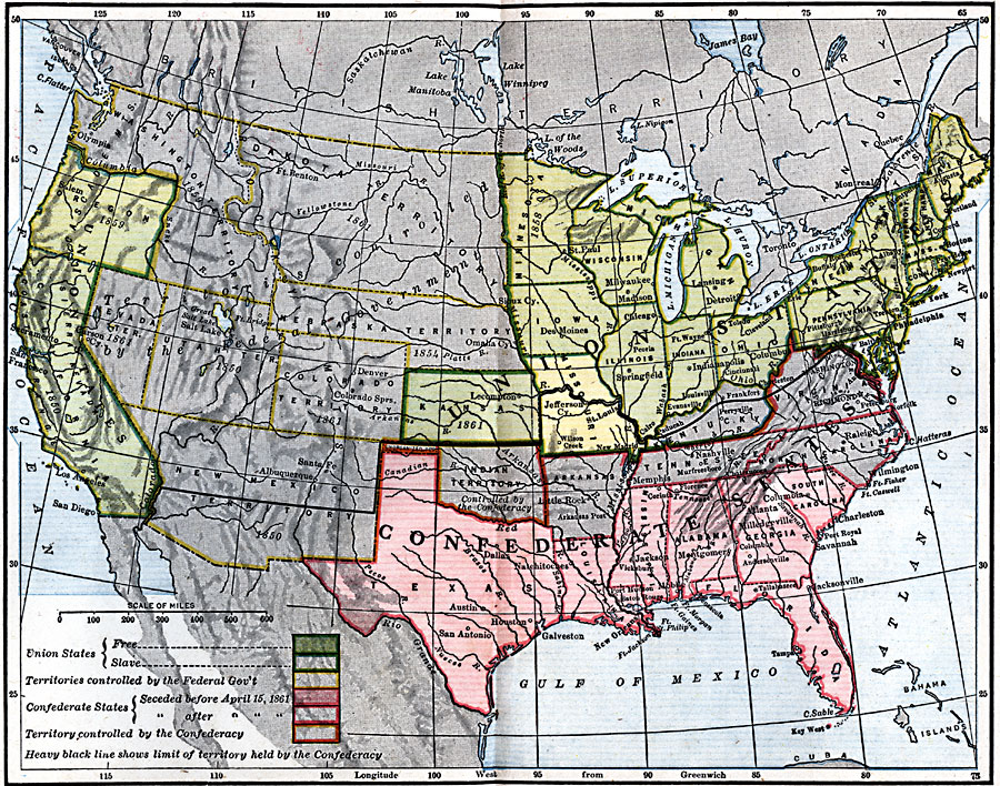
Description: A map of the United States and Confederate States in 1861. The map is color–coded to show Free Union States, Slave Union States, Confederate States seceding before April 15, 1861, Confederate States seceding after April 15, 1861, territories controlled by the Federal Government, and territories controlled by the Confederacy. A heavy black line shows the limit of territory held by the Confederacy. The map shows state and territory boundaries, state capitals and major cities, and the dates of statehood or territorial organization for areas west of the Mississippi River.
Place Names: Civil War, Confederate territory, �Union States, �Confederate States, �Federal Government Territory, �free state
ISO Topic Categories: boundaries,
location,
oceans,
inlandWaters
Keywords: United States and Confederate States, physical, �political, �historical, physical features, major political subdivisions,
country borders, Civil War, boundaries,
location,
oceans,
inlandWaters, Unknown, 1861
Source: Robert Hall, Harriet Smither, and Clarence Ousley, A History of the United States (Dallas, TX: The Southern Publishing Company, 1920) 330-331
Map Credit: Courtesy the private collection of Roy Winkelman |
|