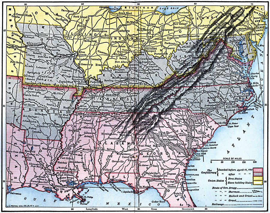
Description: A map from 1920 of the Southeastern States showing the South's first line of defenses during the American Civil War (1861–1865). The map is color–coded to show the eastern Confederate States (indicating the States seceding before and after April 15, 1861), and Union States (indicating Free States and Slave holding States). The map shows major cities, railways, mountain systems, rivers, and the campaign routes of General Bragg, General Sherman, Halleck and Grant, and General Grant.
Place Names: Civil War, Raleigh, �Tallahassee, �Jacksonville, �Delaware, �Jersey, �Trenton, �Baton Rouge, �Jefferson City, �Port Royal, �Annapolis, �Atlanta, �New Orleans, �Confederate territor
ISO Topic Categories: location,
inlandWaters,
oceans,
transportation,
boundaries,
intelligenceMilitary
Keywords: First Defenses of the South during the American Civil War, historical, �transportation, �physical, �political, physical features, major political subdivisions, railroads, Civil War, location,
inlandWaters,
oceans,
transportation,
boundaries,
intelligenceMilitary, Unknown, 1860–1865
Source: Robert Hall, Harriet Smither, and Clarence Ousley, A History of the United States (Dallas, TX: The Southern Publishing Company, 1920) 346-347
Map Credit: Courtesy the private collection of Roy Winkelman |
|