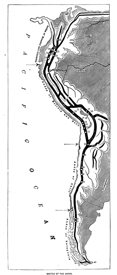
Description: An orographic sketch map from 1873 of the Andes mountain chains. The map divides the system into the Andes of Columbia and Ecuador, Andes of Bolivia and Peru, Andes of Chile, and Andes of Patagonia. The map is keyed to show the prominent peaks and volcanoes of the Andes, including (south to north) Volcano Sarmiento (1),Volcano Yanteles (2),Volcano Corcovado (3),Volcano Ozurno (4),Volcano Maypu (5),Volcano Tupungato (6),Volcano Aconcagua (7),Volcano Dona Anna (8),Volcano Copiapo (9),Volcano Llullayacu (10),Volcano Dirima (11),Volcano Coipasa (12),Volcano Gualateiri (13),Volcano Sahama (14),Volcano Arequipa (15), Illimani (16),Sorata (17),Volcano Assuay (18),Chimborazo (19),Volcano Catocachi (20),Volcano Cayanibe (21),Volcano Cotopaxi (22),Volcano Antisana (23), and Volcano Tolima (24). Other keyed features include Plateau of Bolivia (P.B.), Plateau of Caxamarca (C.), Lake Titicaca (T.), Plateau of Quito (Q.), Amazon River (a.), Orinoco River (b.), Magdalena River (c.), and Cauca River (d.).
Place Names: A Regional Map of South America, Bolivia, �Peru, �Ecuador, �Columbia, �Chile, �Patagonia,
ISO Topic Categories: location,
oceans,
inlandWaters
Keywords: The peaks and volcanoes which form the Andes, physical, physical features, location,
oceans,
inlandWaters, Unknown, 1873
Source: D. M. Warren, Elementary Treatise on Physical Geography (Philadelphia, Pennsylvania: Cowperthwait and Co., 1873) 23
Map Credit: Courtesy the private collection of Roy Winkelman |
|
