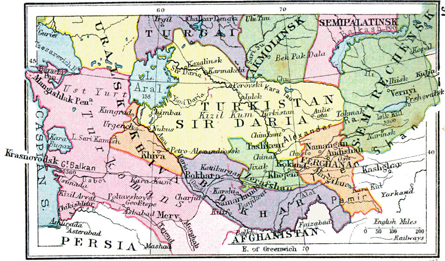
Description: A map from 1920 of the Central Asian territories of Russia at the time, including the provinces of Sir Daria, Khiva, Turkomans (Trans Caspian), Bokhara, Samarkand, Ferghana, and portions of Turgai, Uralsk, Semipalatinsk, Akmolinsk, and Semirechinsk. The map shows major cities and towns, railways, lakes, rivers, and the frontiers at the time of Afghanistan and Persia.
Place Names: Russia, Semirechensk, �Akmolinsk, �Turgai, �Uralsk, �Khiva, �Turkistan, �Sir Daria, �Bokhar
ISO Topic Categories: boundaries,
inlandWaters,
location,
oceans,
transportation
Keywords: Russian Central Asia, physical, �political, �transportation, physical features, country borders,
major political subdivisions, railroads, boundaries,
inlandWaters,
location,
oceans,
transportation, Unknown, 1920
Source: , Asprey's Atlas of the World (London, England: Asprey and Co., Ltd., 1920) 97
Map Credit: Courtesy the private collection of Roy Winkelman |
|
