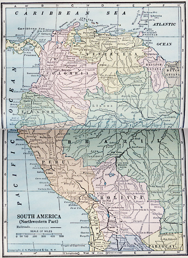
Description: A map from 1922 of the northwestern portion of South America showing the political boundaries at the time for Columbia, Venezuela, British Guiana, Ecuador, Peru, and Bolivia, with portions of Dutch Guiana, Brazil, Chile, Argentina, and Paraguay. The map shows state boundaries within countries, capitals and major cities, towns, ports, railroads, rivers, terrain, and coastal features.
Place Names: A Regional Map of South America, Venezuela, �Columbia, �Ecuador, �Brazil, �Peru, �British Guiana, �Dutch Guiana, ��Bolivia, �Chile, �Paragua
ISO Topic Categories: boundaries,
location,
inlandWaters,
oceans,
transportation
Keywords: Northwest Part of South America, physical, �political, �transportation, physical features, country borders, railroads, boundaries,
location,
inlandWaters,
oceans,
transportation, Unknown, 1922
Source: , Putnam's Handy Map Book (New York, New York: G. P. Putnam's Sons, 1922) 56-57
Map Credit: Courtesy the private collection of Roy Winkelman |
|