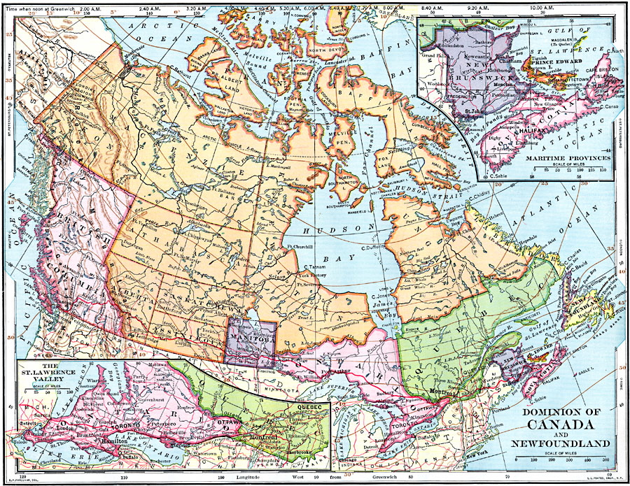
Description: A map from 1902 of the Dominion of Canada, showing provinces, province capitals and major cities, railroads, canals, mountain systems, lakes, rivers, and coastal features. Symbols on the map indicate the head of navigable rivers (anchor symbol) and dam sites on rivers. The mean annual isotherms in degrees Fahrenheit are shown, as well as the longitudinal time zones based on noon Greenwich Time at the top of the map, and latitudinal references to world cities on the side margins. Although the text states "Canada comprises the provinces of Ontario, Quebec, New Brunswick, Nova Scotia, Prince Edward Island, Manitoba, British Columbia, Saskatchewan, Alberta, and the vast, thinly settled territory in the north that has not yet been divided into provinces," the map shows boundaries for the Yukon, Mackenzie, Athabasca, Assinboia, Keewatin, Ungava, Baffin Land, and Labrador territories. Inset maps detail the St. Lawrence Valley region and the Maritime Provinces.
Place Names: Canada, Canada, �Newfoundlan
ISO Topic Categories: oceans,
location,
inlandWaters
Keywords: The Dominion of Canada and Newfoundland, borders, �historical, physical features, climate, oceans,
location,
inlandWaters, Unknown, 1902
Source: H. Justin Roddy, Complete Geography (New York, NY: American Book Company, 1902) 72
Map Credit: Courtesy the private collection of Roy Winkelman |
|