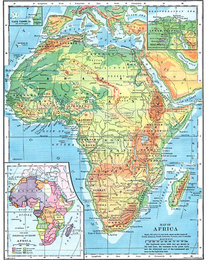
Description: A physical map of the African continent showing general elevations color coded as highlands above 2,000 feet in buff tints, lowlands in green tints, and the offshore continental shelf in light blue. Major rivers, lakes, mountains, and other landforms are shown, as well as major cities and trade centers. Inset maps detail the Cape Verde Islands and the Nile Delta, including a map showing the chief political divisions, or European land claims established at the Berlin Conference in 1885.
Place Names: A Complete Map of Africa, Algeria, �Congo, �Egypt, �Ethiopia, �Lybia, �Madagascar, �Nigeria, �Somalia, �South Africa, �Suda
ISO Topic Categories: oceans,
location,
inlandWaters
Keywords: Geopolitical Map of Africa, borders, �historical, �transportation, �meteorological, kBerlinConference, physical features, railroads,
water routes, climate, oceans,
location,
inlandWaters, Unknown, 1902
Source: H. Justin Roddy, Complete Geography (New York, NY: American Book Company, 1902) 124
Map Credit: Courtesy the private collection of Roy Winkelman |
|