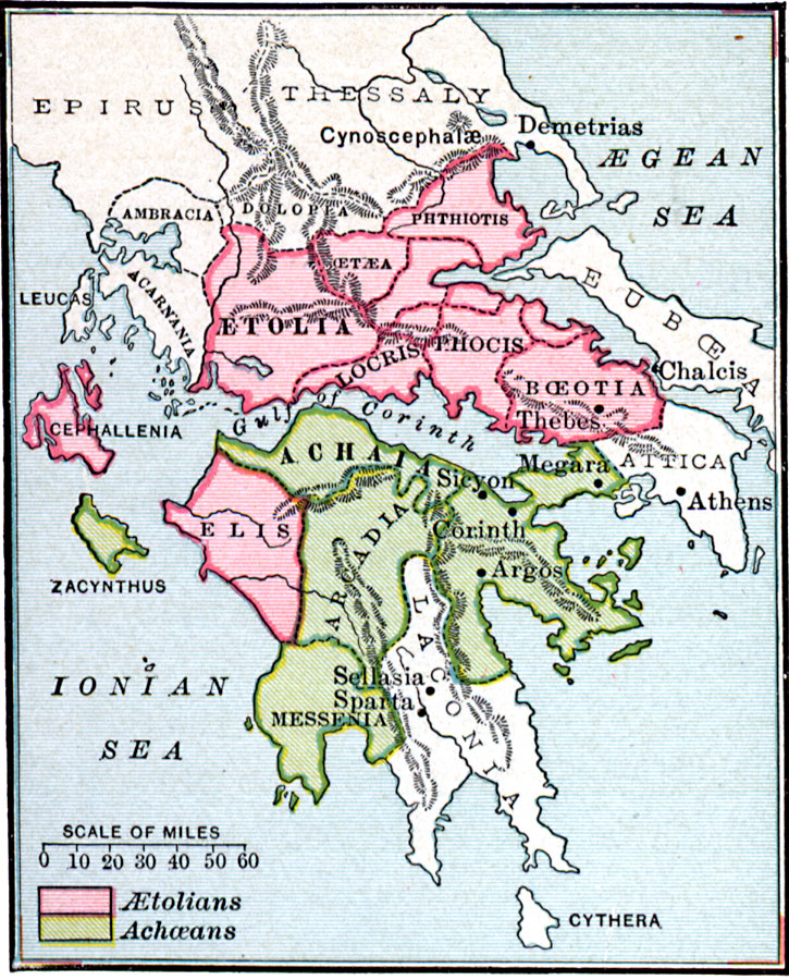
Description: Map showing the Greek &Aelig;tolian and Achæan Leagues, from about 229 B.C. This map shows the &Aelig;tolian confederation of &Aelig;tolia, Oetæa, Phthiotis, Locris, Phocis, Boeotia, Cephallenia, and Elis, and the Achæan confederation of Achaia, Arcadia, Zacynthus, and Messenia. The maps shows important cities of the time, including Thebes, Megara, Sicyon, Corinth, Argos, and the non–league cities of Demetrias, Chalcis, Athens, Sellasia, and Sparta.
Place Names: Greece, Achaia, �Etolia, �Greece, �Laconia, �Macedonia, �Media,
ISO Topic Categories: oceans,
location,
inlandWaters
Keywords: The AEtolian and Achaean Leagues, borders, kAncientGreece, oceans,
location,
inlandWaters, Unknown, 229 B.C.
Source: William C. Morey, Outlines in Greek History with a survey of Ancient Oriental Nations (New York, NY: The Athenium Press, 1908) 336
Map Credit: Courtesy the private collection of Roy Winkelman |
|