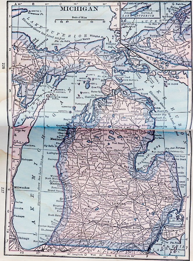
Description: A map from 1922 of Michigan showing the capital city of Lansing, major cities and towns, railroads, rivers, and lake shoreline. An inset map shows the northwestern continuation of the Upper Peninsula with a detail of Isle Royale.
Place Names: Michigan, Jackson, �Pontiac, �Detroit, �Grand Rapids, �Lansing, �Flint, �Kalamazoo, �East Saginaw, �Battle Cree
ISO Topic Categories: location,
inlandWaters,
boundaries
Keywords: Michigan, physical, physical features, location,
inlandWaters,
boundaries, Unknown, 1922
Source: , Putnam's Handy Map Book (New York, NY: G. P. Putnam's Sons, 1922) 226-227
Map Credit: Courtesy the private collection of Roy Winkelman |
|