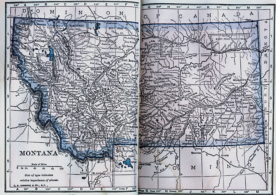
Description: A map from 1922 of Montana showing the capital of Helena, major cities and towns, Indian reservations, railroads, rivers, and mountains. The boundaries of Yellowstone National Park, primarily in Wyoming, are shown.
Place Names: Montana, Helena, �Livingston, �Bozeman, �Butte, �Anaconda, �Fort Benton, �Missoula, �Billing
ISO Topic Categories: boundaries,
location,
inlandWaters
Keywords: Montana, physical, kNativeAmerican, physical features, boundaries,
location,
inlandWaters, Unknown, 1922
Source: , Putnam's Handy Map Book (New York, NY: G. P. Putnam's Sons, 1922) 240-241
Map Credit: Courtesy the private collection of Roy Winkelman |
|