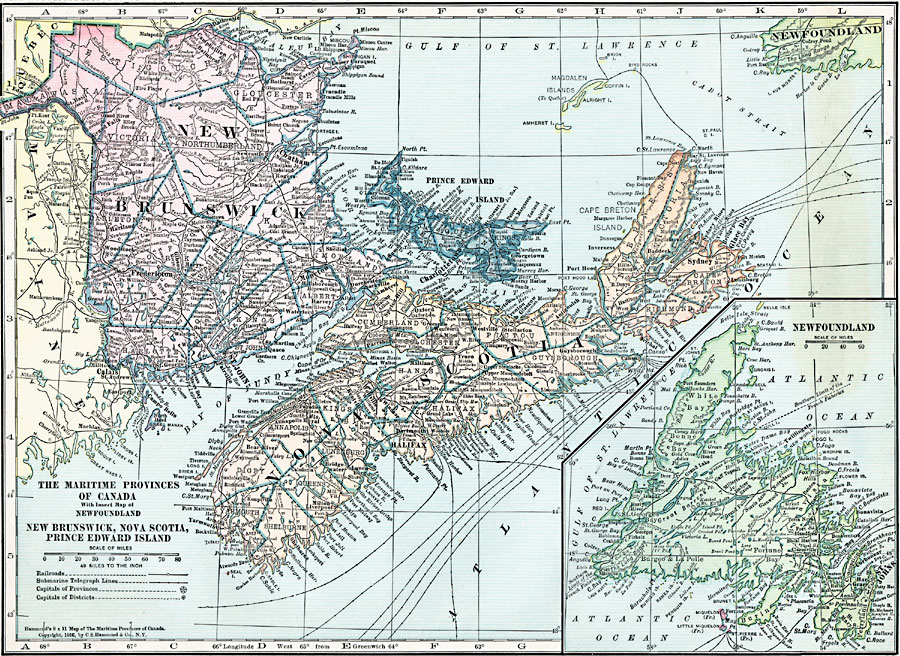
Description: A map from 1920 of the Canadian Maritime Provinces of New Brunswick, Nova Scotia, and Prince Edward Island, with an inset map of Newfoundland. The map shows the county boundaries within the provinces, the provincial capitals of Fredericton (New Brunswick), Halifax (Nova Scotia), and Charlottetown (Prince Edward Island), major cities, towns, and ports, railways, submarine telegraph cable routes, coastal features and smaller islands.
Place Names: Canada, New Brunswick, �Nova Scotia, �Newfoundland, �Prince Edward Island,
ISO Topic Categories: boundaries,
location,
inlandWaters,
oceans,
transportation
Keywords: Maritime Provinces of Canada, physical, �transportation, physical features, railroads, boundaries,
location,
inlandWaters,
oceans,
transportation, Unknown, 1920
Source: , Hammond's Modern Atlas of the World (New York, NY: C. S. Hammond and Company, Inc., 1920) 4
Map Credit: Courtesy the private collection of Roy Winkelman |
|