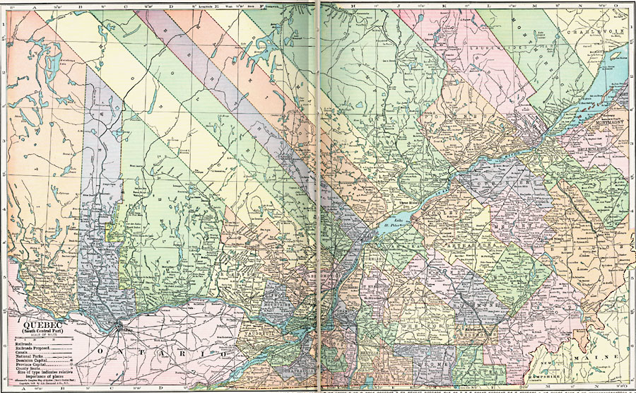
Description: A map from 1920 of the south–central part of the province of Quebec, showing county boundaries and county seats, the Dominion capital of Ottawa, Province capital of Quebec City, major cities, towns, and ports, existing and proposed railways, canals, provincial park boundaries, lakes, rivers, and coastal features of the province.
Place Names: Canada, Quebe
ISO Topic Categories: boundaries,
location,
inlandWaters,
transportation,
environment
Keywords: South Central Quebec, physical, �transportation, physical features, railroads,
water routes, boundaries,
location,
inlandWaters,
transportation,
environment, Unknown, 1920
Source: , Hammond's Modern Atlas of the World (New York, NY: C. S. Hammond and Company, Inc., 1920) 6-7
Map Credit: Courtesy the private collection of Roy Winkelman |
|