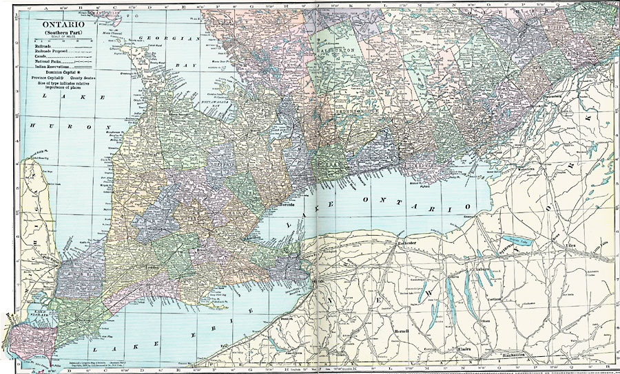
Description: A map from 1920 of the southern part of the province of Ontario. The map shows the county boundaries and county seats, Dominion capital of Ottawa, the provincial capital of Toronto, major cities and towns, existing and proposed railways, canals, provincial park boundaries, Indian reservation boundaries, lakes, and rivers of this portion of the province.
Place Names: Canada, Ontario, �Toronto, �Ottawa,
ISO Topic Categories: boundaries,
location,
inlandWaters,
transportation,
environment
Keywords: Southern Ontario, physical, �transportation, physical features, railroads,
water routes, boundaries,
location,
inlandWaters,
transportation,
environment, Unknown, 1920
Source: , Hammond's Modern Atlas of the World (New York, NY: C. S. Hammond and Company, Inc., 1920) 8-9
Map Credit: Courtesy the private collection of Roy Winkelman |
|