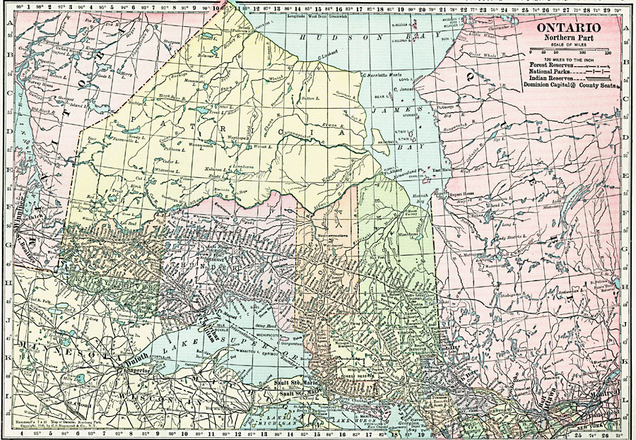
Description: A map from 1920 of the northern part of the province of Ontario. The map shows the capital of Ottawa, major cities and towns, existing and proposed railways, county boundaries, forest reserve boundaries, national park boundaries, Indian reserve boundaries, lakes, the watershed division line, and rivers of this portion of the province. The latitude and longitude grid is shown at one degree increments.
Place Names: Canada, Ottawa, �Toronto, �Winnipeg, �Montrea
ISO Topic Categories: boundaries,
environment,
location,
inlandWaters
Keywords: Northern Ontario, physical, physical features, boundaries,
environment,
location,
inlandWaters, Unknown, 1920
Source: , Hammond's Modern Atlas of the World (New York, NY: C. S. Hammond and Company, Inc., 1920) 10
Map Credit: Courtesy the private collection of Roy Winkelman |
|